Catalog Archive
Auction 112, Lot 161

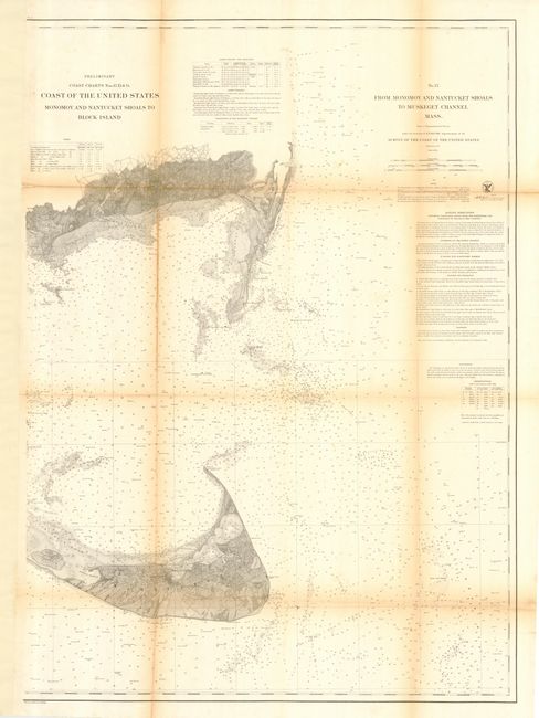
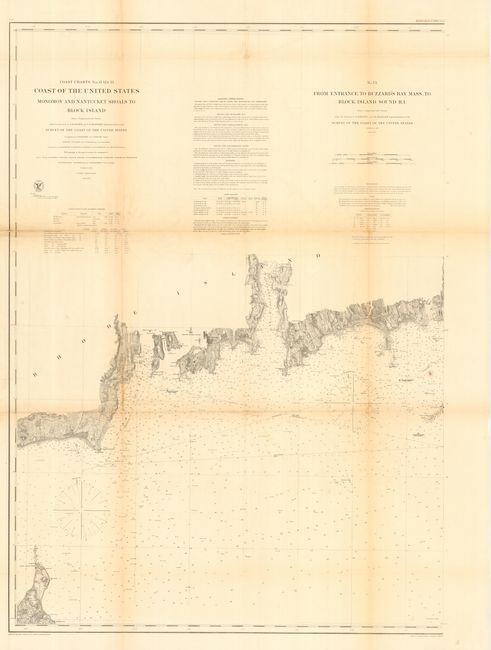
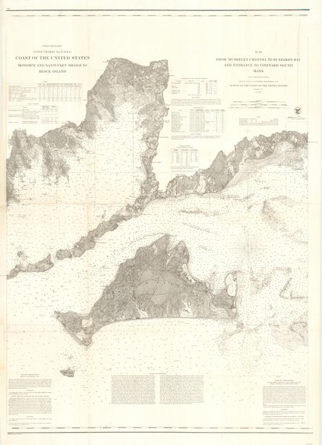
"[Lot of 3] Coast of the United States. Monomoy and Nantucket Shoals to Block Island…", U.S. Coast Survey

Subject: New England

Period: 1860 (dated)

Publication:

Color: Black & White

Size:
27 x 37.5 inches
68.6 x 95.3 cm
Download High Resolution Image
(or just click on image to launch the Zoom viewer)

This early, matched set of charts provides a detailed examination of the Northeast Atlantic in the vicinity of Nantucket and Martha's Vineyard. Filled with sailing directions, dangers in the area, and information on tides, winds, currents, etc. The charts share the common title "Coast of the United States. Monomoy and Nantucket Shoals to Block Island..." with sub-titling to describe each map. Each map includes a table detailing the location, height, and distance visible from sea for each light house. "No. 12 From Monomoy and Nantucket Shoal to Muskeget Channel Mass" ; "No. 13 From Entrance to Buzzard's Bay Mass. To Block Island Sound R.I."; and "No. 13 - From Muskeget Channel to Buzzard's Bay and Entrance to Vineyard Sound Mass" The third chart is also numbered 13, an obvious mislabeling. Size given is approximate for each chart. Dated 1860, these are early examples of this series of scarce charts.

References:

Condition: B

Issued folding, now backed with archival tissue. Some toning along folds.

Estimate: $500 - $600

Sold for: $550

Closed on 9/28/2005

Archived