Catalog Archive
Auction 111, Lot 659

"A Map of the Discoveries made by Capt:n Will:m Dampier in the Roebuck in 1699", Bowen, Emanuel

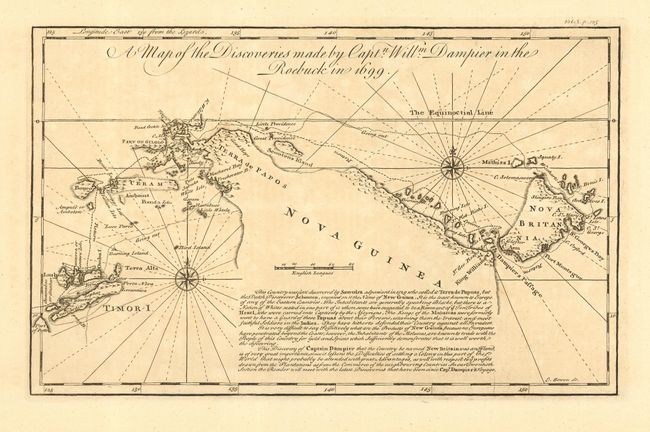
Subject: East Indies - Indonesia

Period: 1744 (circa)

Publication: Harris' Navigations…

Color: Black & White

Size:
12.5 x 7.8 inches
31.8 x 19.8 cm
Download High Resolution Image
(or just click on image to launch the Zoom viewer)

This copper engraved map chronicles Dampier's discovery of New Britain Island in the Bismark Sea. The map includes the Indonesian island of Timor and surrounding islands, Iraian Jaya and part of Papua New Guinea. Dampier is credited as making the first comprehensive English contact with Australia, then known as New Holland. After visiting New Holland he sailed along the northern coast of Papua New Guinea, Timor, then to New Britain and finally westward through some of the East Indies, stopping in Batavia (Jakarta) on Java.

References:

Condition: A

Dark impression and full margins on fine hand laid paper. Overall lightly toned and one paper flaw in blank area, still very good.

Estimate: $180 - $240

Sold for: $95

Closed on 6/8/2005

Archived