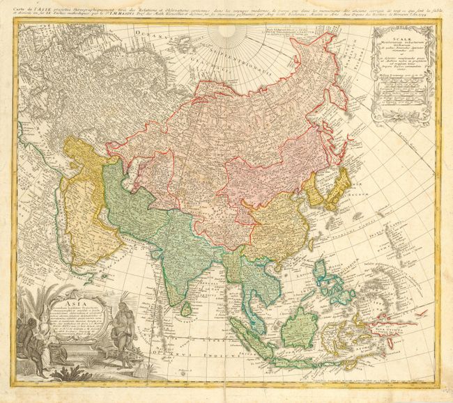
Attractive 18th century map of the continent and the East Indies drawn by Matthias Haas. The extent of European knowledge of the region is vividly depicted with good detail throughout. The work of the Jesuit missionaries is reflected in the well-documented region of China. Kamchatka has been reduced to its proper size from Johan Christoph Homann's earlier map, while Siberia is clearly based on Russian surveys that were published in the early 1730's. Japan is still shown with Hokkaido (Terra Eso, Yedso ou Yesfo) attached to the mainland. The large title cartouche includes an elaborate scene of an Asian queen surrounded by wealth and incongruously an Amazon queen also appears in the scene.
References: Yeo #129.
Condition: B
Light damp stains in the upper margin, two worm tracks in side margins that are covered with archival tape on verso. Bottom fold separation just entering map, closed with archival tape.