Catalog Archive
Auction 111, Lot 363

"Magnae Britanniae et Hiberniae Tabula", Hondius/Blaeu
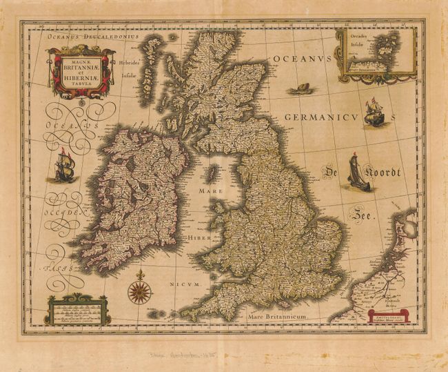
Subject: Britain

Period: 1635 (circa)

Publication:

Color: Hand Color

Size:
19.1 x 15 inches
48.5 x 38.1 cm
Download High Resolution Image
(or just click on image to launch the Zoom viewer)

This handsome map of the British Isles is believed to be printed from the revised plate of Hondius' carte-a-figures map of 1630. Blaeu acquired a number of Jodocus Hondius' plates from Hondius' widow in 1629. As this map was too large to fit in Blaeu's atlas, it is presumed that he removed the surrounding panels. The map appeared in many of the Blaeu atlases between 1634 and 1672 and was included in all editions of the Blaeu atlas of England and Wales from 1645 onwards. Latin text on verso.

References: Moreland & Bannister p. 217.

Condition: B

Sharp impression and original color. Evenly toned with a professional repair of a couple of oxidation cracks. Some mat burn and adhesive residue in blank margins.

Estimate: $1,200 - $1,400

Unsold

Closed on 6/8/2005

Archived