Catalog Archive
Auction 111, Lot 320

"Kaart van geheel Guajana of de Wilden-kust, en die der Spaansche Westindien, op het Noord-end van Zuid-Amerika", Tirion, Isaac
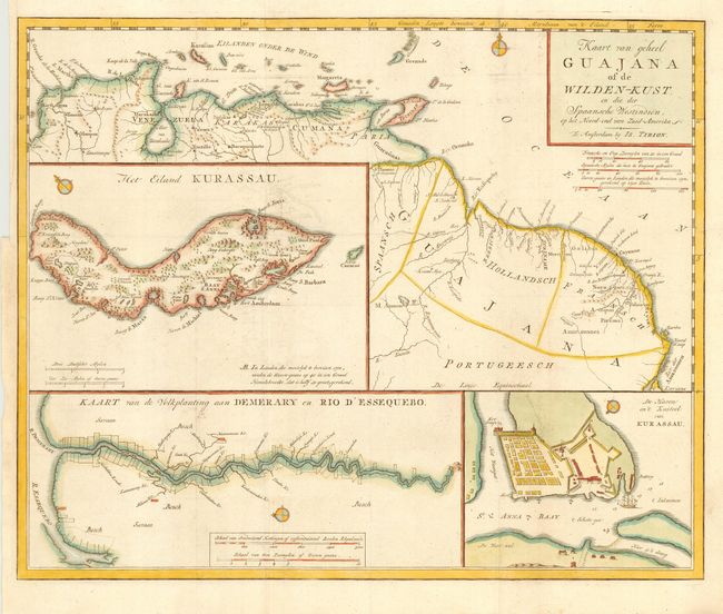
Subject: Guyana

Period: 1769 (circa)

Publication:

Color: Hand Color

Size:
15.9 x 12.9 inches
40.4 x 32.8 cm
Download High Resolution Image
(or just click on image to launch the Zoom viewer)

Handsome and interesting map of the northern coastline from Colombia through French Guyana. Includes three large insets of the island of Kurassau (Curacao), a detailed map of the harbor and Dutch fort on Curacao, and a map of the Dutch colony of Demerary and Essequebo showing plantations along the rivers.

References:

Condition: B

Folding as issued with normal binding trim. Original color. Bit of minor offsetting and surface soil, else very good.

Estimate: $350 - $400

Sold for: $300

Closed on 6/8/2005

Archived