Catalog Archive
Auction 111, Lot 197

"The Rand-McNally New Commercial Atlas Map of California", Rand McNally & Co.
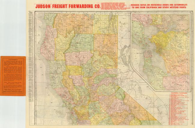
Subject: California

Period: 1914 (circa)

Publication:

Color: Printed Color

Size:
25.5 x 19 inches
64.8 x 48.3 cm
Download High Resolution Image
(or just click on image to launch the Zoom viewer)

Large, folding pocket map printed with Southern California on one side and Northern California on the other. Large inset of San Francisco and Vicinity on the northern side, and two insets on the southern side: Los Angeles and Vicinity and San Diego and Vicinity. Remarkably detailed including delineating and naming 44 railroads throughout the state. Large red overprinting at top on both sides "Judson Freight Forwarding Co., Reduced Rates on Household Goods and Automobiles to and from California and other Western Points." Folds into pictorial wrappers advertising the freight company. A very nice promotional piece. Map is not dated but mentions the 1910 census and the opening of the Panama Canal.

References:

Condition: A

Near fine, with only a few splits at fold intersections.

Estimate: $100 - $140

Sold for: $65

Closed on 6/8/2005

Archived