Catalog Archive
Auction 111, Lot 161

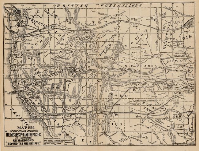
"Map of the Region Between the Mississippi and the Pacific", Richardson, Albert D.

Subject: United States - Western

Period: 1869 (dated)

Publication: Beyond the Mississippi

Color: Black & White

Size:
9.8 x 7.4 inches
24.9 x 18.8 cm
Download High Resolution Image
(or just click on image to launch the Zoom viewer)

The map extends into Wisconsin and depicts a large Dacotah Territory, numerous railroads (completed and in progress), ancient ruins, towns, topography and watershed, the "Old Missouri Compromise Line" and much more. The map is nearly the first to use the term Grand Canyon, here calling it the Great Canyon. The map's geography is up-to-date enough to locate and name the Pah Ranagat Mining District in Nevada, but missed the change in boundary between Nevada and Arizona that occurred three years earlier. Richardson was a newspaper correspondent who traveled extensively in the West. The first edition of the book and map were from 1867, this being an unrecorded second edition, dated 1869. Wheat devotes over a full page to the highly detailed lithographic map.

References: Wheat (TMW) #1172.

Condition: A

Hint of centerfold toning, still very good.

Estimate: $120 - $180

Sold for: $190

Closed on 6/8/2005

Archived