Catalog Archive
Auction 111, Lot 160

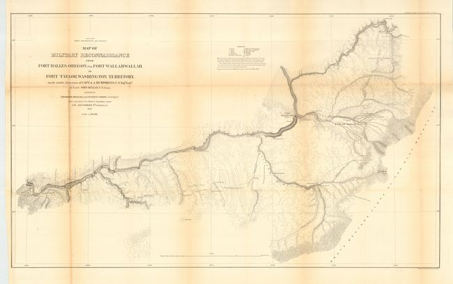
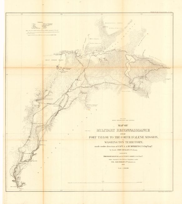
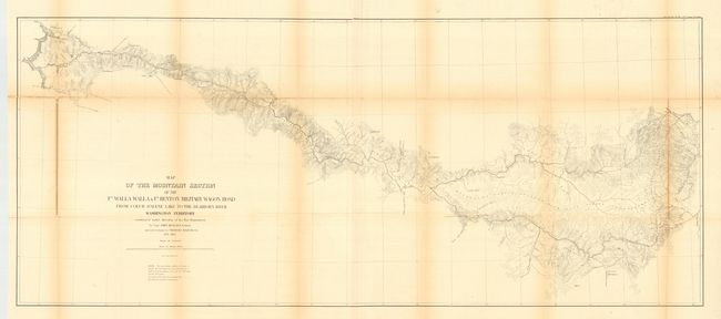
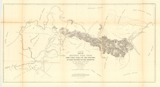
"[Lot of 4 - Pacific Wagon Roads]", U.S. Army

Subject: United States - Western

Period: 1863 (dated)

Publication: Senate Doc 43, 37th Cong 3rd Sess.

Color: Black & White

Size:
See Description
Download High Resolution Image
(or just click on image to launch the Zoom viewer)

This lot consists of 3 sectional maps and a general map covering the Mullan Trail. The road was constructed [1859-62] to facilitate movement of troops and supplies but the need never materialized and the Civil War diverted attention elsewhere. Wheat states "The Mullan Trail was unquestionable the most famous road ever constructed in the high Northwest." Its importance lies in its use as an emigrant route to the Northwest and for miners who followed the gold rush into Idaho and Montana.

Lot includes: 1) Map of Military Reconnaissance from Fort Dalles, Oregon, via Fort Wallah-Wallah, to Fort Taylor, Washington Territory (35.5 x 21.2") 2) Map of Military Reconnaissance from Fort Taylor to the Coeur d'Alene Mission (20.3 x 21.5") 3) Map of Military Road from Fort Walla Walla on the Columbia to Fort Benton on the Missouri (33.7 x 17.3") 4) Map of the Mountain Section of the Ft. Walla Walla & Ft. Benton Military Wagon Road from Coeur d'Alene Lake to the Dearborn River (49.7 x 21"). Rarely offered as a full set of these important maps.

References: Wheat (TMW) #1077, 1078, 1079, and 1080.

Condition: B

All issued folding, now pressed and backed with archival tissue. Toning along folds.

Estimate: $450 - $600

Sold for: $250

Closed on 6/8/2005

Archived