Catalog Archive
Auction 111, Lot 110

"Karte des nordlichsten America…", Sotzmann, Daniel Friedrich

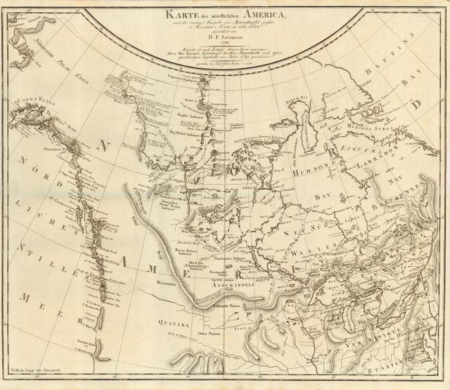
Subject: Colonial Canada & United States

Period: 1791 (dated)

Publication:

Color: Black & White

Size:
18.8 x 15.5 inches
47.8 x 39.4 cm
Download High Resolution Image
(or just click on image to launch the Zoom viewer)

This rare map of the northern part of North America is apparently the first map to show Mackenzie's discoveries in the Arctic. The geography was based on Arrowsmith and Long and covers the Pacific coast from Cook's Inlet to Cape Mendocino in the west and from Baffins Bay to Virginia in the east. It is filled with fine topographical detail, Indian tribes, a nearly complete hypothetical Northwest Passage, and extensive exploration details in the Arctic regions of Canada. The map was published in one of Georg Forster's two books on exploration in North America, published in 1791-92. Mackenzie's own map of his discoveries was not published until 1801.

Daniel Sotzmann was a renowned German cartographer who is best known for the incredibly rare maps he made for Ebiling's Atlas von Nordamerika. Sotzmann was named geographer of the Akademie der Wissenschaft in Berlin in 1786. Between 1783 and 1806 he produced a number of district, province and city maps of Germany in association with Carl Ludwig Oesfeld. Their work laid the foundations for the cartographic style used by many German cartographers throughout the nineteenth century. Although most of Sotzmann's maps were of German regions, he prepared two maps of North America (including this one). According to Lister, these maps may have brought Sotzmann to Ebeling's attention; thus resulting in the fabulous maps in the Atlas von Nordamerika.

References: Kershaw #491; Ristow, p.177; not listed in Wagner or Wheat.

Condition: A+

Folding with narrow margins as issued. Slight toning at paper edges, still fine.

Estimate: $1,000 - $1,300

Sold for: $750

Closed on 6/8/2005

Archived