Catalog Archive
Auction 110, Lot 87

"Amerique Septentrionale", Levasseur, Victor

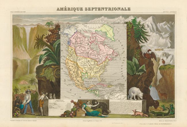
Subject: North America

Period: 1845 (circa)

Publication: Atlas National Illustre

Color: Hand Color

Size:
17 x 11 inches
43.2 x 27.9 cm
Download High Resolution Image
(or just click on image to launch the Zoom viewer)

Lovely map with the Republic of Texas, the United States extending into present-day Canada, Russia in control of Alaska, and Mexico's northern border according to the Treaty of 1819 (mis-printed 1810). Surrounded by beautifully engraved scenes of North and Central America including local animals, a ship stranded in the polar sea, and a Mayan temple. A very popular and decorative 19th century map. Full color of both map and surrounding scenes.

References:

Condition: A+

Estimate: $350 - $400

Sold for: $325

Closed on 3/2/2005

Archived