Catalog Archive
Auction 110, Lot 668

"A Mapp of the Higher and Lower Aethiopia Comprehending ye Several Kingdomes &c in each to witt in the Empire of the Abissines…", Blome, Richard

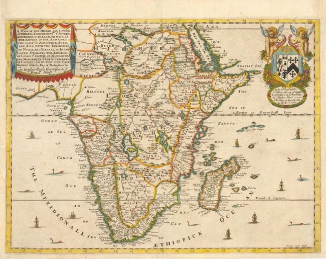
Subject: Africa - Southern and Eastern

Period: 1680 (published)

Publication: A Geographical Description of the World…

Color: Hand Color

Size:
16 x 11.7 inches
40.6 x 29.7 cm
Download High Resolution Image
(or just click on image to launch the Zoom viewer)

This is a scarce and unusual map covering the southern and eastern part of the continent. The map is a based on Sanson's maps of 1655, and is properly credited in the cartouche. The Nile rises from the twin lakes of Zaire and Zaflan located well below the equator. There are numerous other large lakes, spurious topography, and fictitious kingdoms and cities filling the interior. A heraldic dedication to Sir Robert Viner with Blome's imprint is in the upper right corner, and the lengthy title is opposite in a drape-style cartouche. The sea is filled with ships and sea monsters. Blome's maps are important in British cartographic history because his atlases were completely produced in England. There was not a fully developed domestic mapmaking industry at the time, and most English publishers (including John Speed) had their plates engraved and/or printed on the continent. This map was engraved by Francis Lamb.

References: Tooley (MCC-47) p. 25.

Condition: B

Overall very attractive. Remargined at both sides with some pencil facsimile of neatlines.

Estimate: $700 - $800

Sold for: $500

Closed on 3/2/2005

Archived