Catalog Archive
Auction 110, Lot 346

"[Lot of 2] A Map of Durham [and] Bishoprick of Durham [chart of distances]", Owen & Bowen
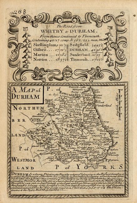
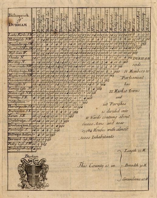
Subject: England

Period: 1755 (circa)

Publication: Britannia Depicta

Color: Black & White

Size:
See Description
Download High Resolution Image
(or just click on image to launch the Zoom viewer)

The former is a fine copper engraving with a large and decorative cartouche that includes the distances from numerous towns in Durham. On the verso of this map is another map (4.7" x 7") showing the road from Mold to Holywell and Chester to Holywell in the strip-map style. Decorated with four compass roses. The latter is a two-dimension mileage chart (5.6" x 7") as we find on road maps today. It shows the cities across the top and then again vertically along the side, the intersection of any two cities gives the mileage between them. With the Coat of Arm of Durham.

References:

Condition: B

A few spots in the Bishoprick chart.

Estimate: $60 - $80

Sold for: $45

Closed on 3/2/2005

Archived