Catalog Archive
Auction 109, Lot 78

"Novissima et Accuratissima Totius Americae Descriptio", Wit, Frederick de

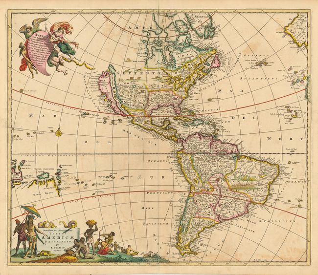
Subject: Western Hemisphere

Period: 1680 (circa)

Publication:

Color: Hand Color

Size:
22.8 x 19.2 inches
57.9 x 48.8 cm
Download High Resolution Image
(or just click on image to launch the Zoom viewer)

This is a close derivative of Nicolas Visscher's influential map of the Americas. Other than the depiction of the island of California, which is shown on the Sanson model, the cartography is unchanged. The interior is lacking any of the recent French discoveries and there is one huge, open-ended, Great Lake and a confused system of rivers in the Mississippi valley. In the Southwest, the Rio del Norto flows from a large interior lake and empties into the sea between the mainland and California. In South America, Parime Lacus is prominent. In the South Pacific a large Quiro Regio coastline is located below the Salomon Islands. The map is embellished with two large cartouches that were also copied by from Visscher. The top cartouche depicts angels struggling with a devil for the soul of a Native American. The pictorial title cartouche contains scenes of gold panning, hunting and a native chief standing beneath an umbrella. The only change De Wit made was that the chief is standing on the left rather than on the right as in Visscher's composition. State 2.

References: McLaughlin #49-2; Tooley p. 120 #31; Wheat [TMW] #52.

Condition: B

Fine original color with a bit of faint offsetting, else fine. Short bottom fold separation professionally repaired.

Estimate: $2,100 - $2,300

Sold for: $1,600

Closed on 12/1/2004

Archived