Catalog Archive
Auction 109, Lot 241

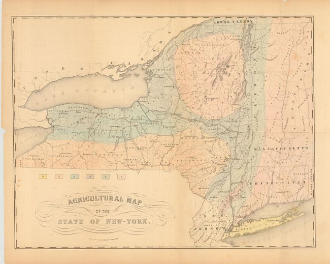
"Agricultural Map of the State of New-York", Endicott & Company
Subject: New York

Period: 1854 (circa)

Publication:

Color: Hand Color

Size:
23.5 x 18 inches
59.7 x 45.7 cm
Download High Resolution Image
(or just click on image to launch the Zoom viewer)

Thematic map that shows six different agricultural areas through hand coloring. The map extends to show all of Connecticut and Vermont, as well as most of Massachusetts and New Hampshire. Indicates counties and major towns. Engraved on stone by G.J. Coring.

References:

Condition: B

On thin paper with delicate pastel wash coloring. Folding as issued with some splits starting on folds. Trace of foxing or toning along one fold.

Estimate: $60 - $70

Sold for: $40

Closed on 12/1/2004

Archived