Catalog Archive
Auction 108, Lot 130

"Plan of York Harbour", Bouchette, Joseph
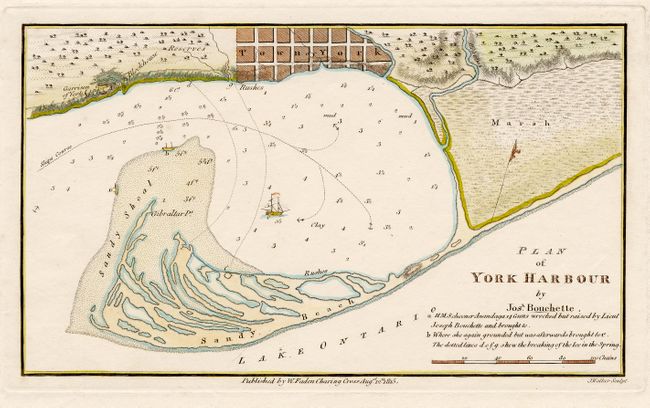
Subject: Canada

Period: 1815 (dated)

Publication:

Color: Hand Color

Size:
9 x 5.2 inches
22.9 x 13.2 cm
Download High Resolution Image
(or just click on image to launch the Zoom viewer)

An early plan of the harbor and settlement of York, which at the time was the capital of Upper Canada. It was re-named Toronto in 1834. In 1793, surveyor Joseph Bouchette laid out the grid of streets for the Town of York on the shores of the natural protected harbor created by the Peninsula (later to become the Toronto Islands). This map shows the wreck location of the H.M.S. Anandaga on the sandy shoal at the harbor entrance. Published by William Faden.

References:

Condition: A

Light foxing in margins.

Estimate: $200 - $240

Sold for: $325

Closed on 9/29/2004

Archived