Catalog Archive
Auction 108, Lot 114

"Theatre de la Guerre en Amerique", Le Rouge, George Louis

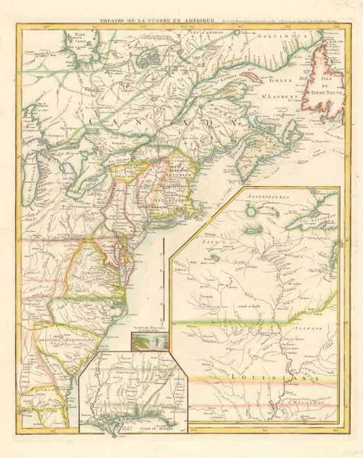
Subject: Colonial United States and Canada

Period: 1777 (dated)

Publication: Atlas Ameriquain Septentrional

Color: Hand Color

Size:
19.8 x 24.3 inches
50.3 x 61.7 cm
Download High Resolution Image
(or just click on image to launch the Zoom viewer)

A fine Revolutionary War period map covering the eastern seaboard from northern Florida to the Gulf of St Laurence, and inland to Lake Michigan and James Bay. The sheet is filled with large insets of the Gulf Coast, the Mississippi River valley and a vignette of Niagara Falls. The map is filled with information on cities, towns, forts, trails, Indian villages and tribal territory, and battlegrounds (both French and Indian War and Revolutionary War). This map was originally drawn in 1755 (with a different title) to illustrate the French and British settlements on the eve of the French and Indian War. At the outbreak of the Revolution the plate was updated and re-titled.

References: McCorkle #777.14; Seller & Van Ee #154.

Condition: A

Overall clean and bright with a few insignificant spots. Wide blank margins with two corners expertly replaced (well away from map).

Estimate: $1,500 - $1,700

Sold for: $2,750

Closed on 9/29/2004

Archived