Catalog Archive
Auction 107, Lot 7

"Orbis Terrarum Typus de Integro Multis In Locis Emendatus", Plancius, Petrus
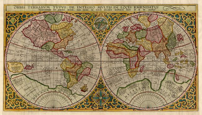
Subject: World

Period: 1630 (circa)

Publication:

Color: Hand Color

Size:
20 x 11.1 inches
50.8 x 28.2 cm
Download High Resolution Image
(or just click on image to launch the Zoom viewer)

This handsome world map, first issued in 1590, was based on Rumold Mercator's map of 1587. It incorporates the improvements made by Ortelius with a re-shaped South America and the inclusion of the Solomon Islands. On this map Plancius introduced new information, based on Portuguese reports, on the far-west coast of America and the western coastline of Africa. Japan is shown for the first time as one small and three larger islands. This example is state 3 from a Dutch Bible with the attribution D.R.M. Mathes. It was beautifully engraved by Baptista Doetecum and set in a strapwork surround with a compass rose and armillary sphere tucked between the hemispheres.

References: Shirley #177.

Condition: A

A fine crisp impression with lovely later color. Side margins extended to accommodate framing, as Bible maps are often found with close outside margins.

Estimate: $4,750 - $5,500

Sold for: $3,000

Closed on 6/9/2004

Archived