Catalog Archive
Auction 107, Lot 245

"Guayane, Terre Ferme, Isles Antilles, et Nlle. Espagne", Brion de la Tour/Desnos

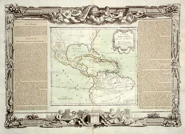
Subject: Caribbean & Northern South America

Period: 1766 (dated)

Publication: Atlas General Methodique et Elementaire

Color: Hand Color

Size:
22 x 17.5 inches
55.9 x 44.5 cm
Download High Resolution Image
(or just click on image to launch the Zoom viewer)

Finely engraved map covering the U.S. and Mexican coastlines, Central America, northern South America and all of the islands of the West Indies. There is no topographical detail shown in North America, as the map concentrates on Central America, the Caribbean and South America. Decorative rococo-style cartouche. The map (10 x 9") with text panels at both sides is surrounded by decorative borders that include scenes of putti, globes, instruments, etc.

References:

Condition: A

Good impression with original coloring. Slightly toned along centerfold, still very good.

Estimate: $200 - $250

Sold for: $160

Closed on 6/9/2004

Archived