Catalog Archive
Auction 107, Lot 233

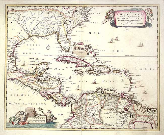
"Insulae Americanae in Oceano Septentrionali ac Regiones Adiacentes, a C. de May usque ad Lineam Aequinoctialem", Visscher, Nicolas

Subject: Gulf of Mexico and Caribbean

Period: 1690 (circa)

Publication:

Color: Hand Color

Size:
22.2 x 18 inches
56.4 x 45.7 cm
Download High Resolution Image
(or just click on image to launch the Zoom viewer)

Decorative map of the Caribbean covering the region from the Chesapeake through the Gulf of Mexico, with Central America and the northern part of South America. Two superb cartouches with cherubs and mermaids decorate opposite corners. Eight ships sail the seas and three native canoes are depicted off the coast of North America. A number of interesting cartographic myths appear on the map, including two large nonexistent lakes in the region of western Georgia, a mountain range extending from the Piedmonts right across the continent, and the archetypal cartographic myth, El Dorado, located on Lacus Parime in Guyana.

References: Portinaro & Knirsch #82.

Condition: B

Original color, light uneven toning and surface soil. Repaired tear at bottom right.

Estimate: $1,200 - $1,300

Sold for: $900

Closed on 6/9/2004

Archived