Catalog Archive
Auction 107, Lot 162

"Topographical Sketch of the Gold & Quicksilver District of California", Ord, E. O. C.
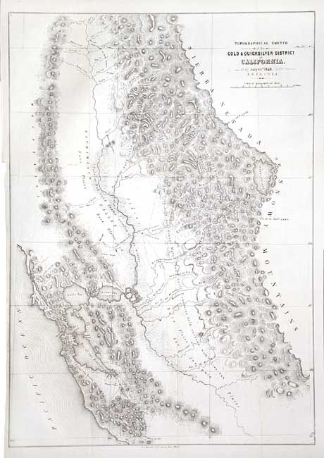
Subject: California

Period: 1848 (dated)

Publication:

Color: Black & White

Size:
15.5 x 21.5 inches
39.4 x 54.6 cm
Download High Resolution Image
(or just click on image to launch the Zoom viewer)

This is considered one of the most important maps of 1848. It accompanied the first official report of the gold discoveries and was the first map to reflect actual conditions at the mines, thus being of paramount importance to the California Gold Rush. It shows in detail the area south of San Francisco Bay (the Quicksilver area), across the Sacramento Valley and San Joaquin Plains and east to Lake Tahoe (here called Mountain Lake). Notes indicate were gold was to be found throughout the region. Lithographed by P.S. Duval, Philadelphia.

References: Wheat [Gold] #54 & [TMW] #565, Schwartz & Ehrenberg p. 278-9.

Condition: A

Issued folding, now backed with archival tissue. Faint trace of toning along fold. Margin extended at binding trim to accommodate framing.

Estimate: $500 - $600

Sold for: $700

Closed on 6/9/2004

Archived