Catalog Archive
Auction 107, Lot 100
"Carte Nouvelle de l'Amerique Angloise contenant tout ce que Anglois possedent sur le Continent de l'Amerique Septentrionale Savoir le Canada, la Nouvelle Ecosse ou Acadie, les treize Provinces unies…", Lotter, Mathias Albrecht
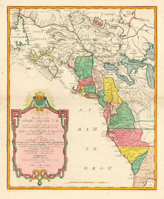
Subject: Colonial United States and Canada
Period: 1776 (circa)
Publication:
Color: Hand Color
Size:
19.4 x 23.7 inches
49.3 x 60.2 cm
Download High Resolution Image
(or just click on image to launch the Zoom viewer)
(or just click on image to launch the Zoom viewer)