Catalog Archive
Auction 106, Lot 93

"Carte Generale de l'Amerique Septentrionale, et des Iles qui en Dependent", Brue, Adrien Hubert

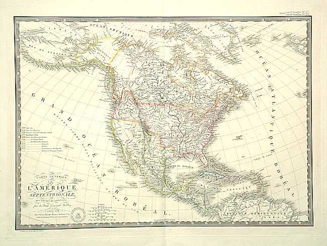
Subject: North America

Period: 1828 (dated)

Publication: Atlas Universel de Geographie…

Color: Hand Color

Size:
20.2 x 14.2 inches
51.3 x 36.1 cm
Download High Resolution Image
(or just click on image to launch the Zoom viewer)

Excellent map of North America and the West Indies. Beautifully engraved on fine heavy paper with the embossed atlas seal below script title. Alaska is Amerique Russe and still a bit misshapen. The United States is shown in control of much of present day British Columbia. The individual state borders are shown up to the Mississippi River. In the west are a large Arkansas Territory and a huge Oregon Territory. Mexico is still in control of Texas and the Southwest. Very fine original outline color complete with color key, surrounded by keyboard style border.

References:

Condition: A

Estimate: $300 - $400

Sold for: $240

Closed on 3/3/2004

Archived