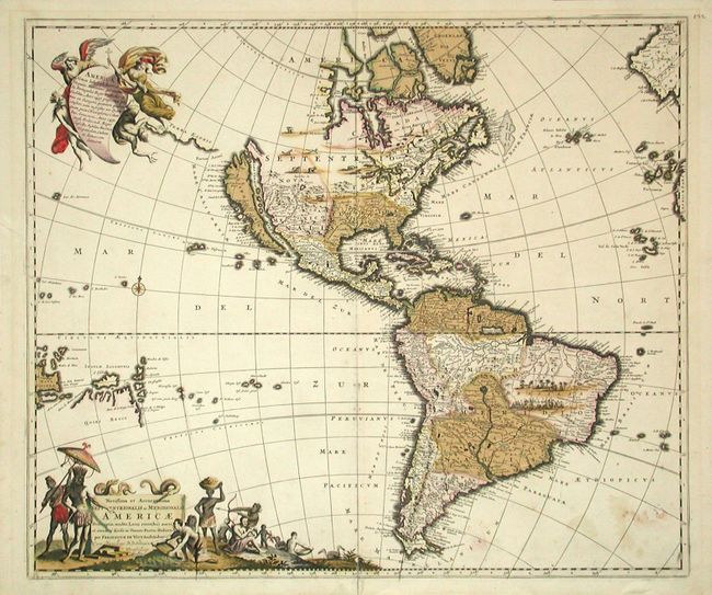
State 3 of this map of the Americas, originally engraved in 1670 and updated with the addition of New Guinea, Solomon Islands, and Quiri Regio, Fretum Aniani and Terra Esonis. While the decorative features follow Visscher, the cartography is largely based on Sanson. California is an Island, the Great Lakes are open-ended in the west, and the R. del Norte flows from a large western lake into the Mare Vermio. De Wit also changed the large title cartouche slightly so that the chief is standing under an umbrella on the left supervising what appears to be a mining scene. The upper cartouche depicts two angels helping a Native American to heaven while a devil falls away. Further embellished with native animals in the north and a village and battle scene in South America.
References: McLaughlin #49, Tooley (America) p. 120 #33.
Condition: B
Original color with some oxidation and minor cracks in green sections, professionally stabilized with Japanese tissue on verso. Some light stains at lower right.