Catalog Archive
Auction 106, Lot 72

"Carte de l'Amerique…", Bertius/Tavernier

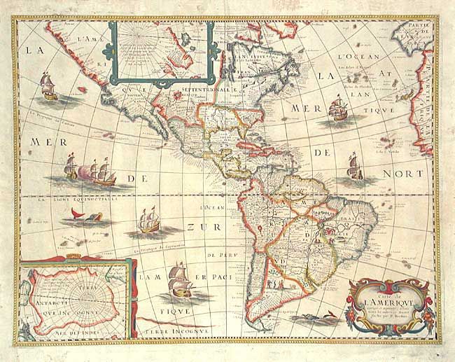
Subject: Western Hemisphere

Period: 1640 (circa)

Publication:

Color: Hand Color

Size:
19.4 x 14.9 inches
49.3 x 37.8 cm
Download High Resolution Image
(or just click on image to launch the Zoom viewer)

According to Burden, "this rare map is one of a set of the four known continents that Melchior Tavernier had engraved, with or without Petrus Bertius' permission is unclear." Burden attributes Cornelis Danckerts (the elder) as the engraver. The map itself bears only the name P. Bertius and while similar to his map of 1624, this map has a completed western coast of North America and different decorations in the sea. Both are based on Jodocus Hondius' map of 1618, with the completion of the southern coast of Tierra del Fuego. The map is richly embellished with two polar insets, a decorative cartouche and numerous ships, sea battles, sea monsters, and scenes of Native American life in South America. Second state with the addition of numerous place names including Neuf Amsterdam, Pleymouth, Accadie and S. Augustino on the east coast, and in the west Nouveau Mexique, N. Albion and Quivera .

References: Burden #218.

Condition: A

Lightly toned with a couple of filled wormholes near center

Estimate: $2,200 - $2,500

Sold for: $1,900

Closed on 3/3/2004

Archived