Catalog Archive
Auction 106, Lot 44

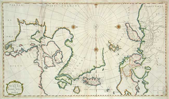
"Carte du Nord Est & du Nord West du Pole", Bernard, Jean Frederic
Subject: Arctic

Period: 1732 (circa)

Publication: Recueil de Voyages au Nord…

Color: Hand Color

Size:
22.5 x 13 inches
57.2 x 33 cm
Download High Resolution Image
(or just click on image to launch the Zoom viewer)

Attractive map of the North Pole including the Canadian Arctic, Hudson's Bay, Greenland, Iceland, Spitzbergen and Nova Zemla. The map is based on Moses Pitt's map of 1680 without Pitt's decorative whaling scenes. Embellished with four compass roses and a title cartouche.

References: Phillips (M) p.117.

Condition: B

Issued folded, now pressed. Slight toning along folds.

Estimate: $500 - $550

Sold for: $300

Closed on 3/3/2004

Archived