Catalog Archive
Auction 106, Lot 297

"Walbrook Ward and Dowgate Ward with their Divisions into Parishes according to a New Survey", Cole, Benjamin

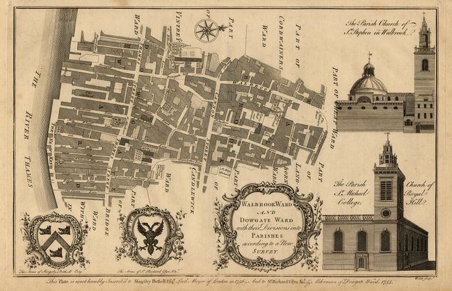
Subject: England - London

Period: 1756 (published)

Publication: Maitland's History and Survey of London

Color: Black & White

Size:
14 x 9 inches
35.6 x 22.9 cm
Download High Resolution Image
(or just click on image to launch the Zoom viewer)

These copperplate engravings were published in William Maitland's History and Survey of London, 1756. They are very detailed maps of the streets, lanes, alleys and courts in the ancient city of London. They are richly embellished with architectural profiles of major churches or important buildings, the arms of the mayor and aldermen, elaborate title cartouches and compass roses.

Plan of Walbrook and Dowgate Wards with views of the churches at St. Stephen in Walbrook and St. Michael Royale.

References:

Condition: A

Couple of faint spots, overall very good.

Estimate: $75 - $100

Sold for: $65

Closed on 3/3/2004

Archived