Catalog Archive
Auction 106, Lot 249

"Carte Reduite des Isles de la Guadeloupe Marie Galante et les Saintes…", Bellin, Jacques Nicolas
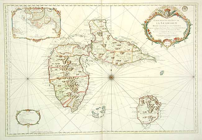
Subject: Guadeloupe

Period: 1759 (dated)

Publication: Hydrographie Francoise

Color: Hand Color

Size:
34.2 x 23 inches
86.9 x 58.4 cm
Download High Resolution Image
(or just click on image to launch the Zoom viewer)

Superb large-scale sea chart with great detail of parishes, forts, towns, settlements, anchorages and topography. Includes Les Saints and Marie Galante. Large inset of environs of Fort Louis surrounded in a delicately engraved border. The chart is centered with a large compass rose with radiating rhumb lines and ornamented with title and distance scale cartouches. Its meticulous topographical and nautical detail makes this one of the major 18th century maps of Guadeloupe.

References: Phillips (A) #590; Sellers & Van Ee #2010.

Condition: A

A few minor printer's creases and tiny spots, overall very good.

Estimate: $800 - $1,000

Unsold

Closed on 3/3/2004

Archived