Catalog Archive
Auction 106, Lot 213

"Map of Oklahoma Territory", General Land Office
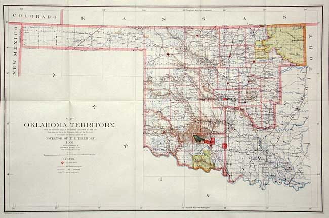
Subject: Oklahoma

Period: 1901 (dated)

Publication:

Color: Printed Color

Size:
22 x 14.4 inches
55.9 x 36.6 cm
Download High Resolution Image
(or just click on image to launch the Zoom viewer)

This map was compiled from the corrected map of the General Land Office 1898 and from data on file in the territorial office to accompany the Annual Report of the Governor of the Territory. It is an attractive map with great attention paid to detail, including railroads constructed and proposed, as well as roads and trails. The map covers present day western Oklahoma with the panhandle, but only the western portion of what was then Indian Territory is shown. Indian reservations within the territory are shown, including the Wichita's, Kiowas, Commanchees and Apaches. Land Offices are located at Woodward, Alva, Enid, Perry, Guthrie, Kingfisher, Ft. Reno, Oklahoma City, Mangum and Lawton.

References:

Condition: A+

Folding as issued.

Estimate: $100 - $150

Sold for: $75

Closed on 3/3/2004

Archived