Catalog Archive
Auction 106, Lot 211

"Ohio", Madison, Bishop James
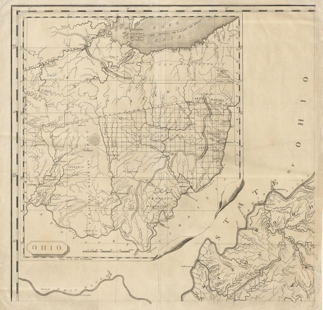
Subject: Ohio

Period: 1807 (published)

Publication:

Color: Black & White

Size:
23 x 22.4 inches
58.4 x 56.9 cm
Download High Resolution Image
(or just click on image to launch the Zoom viewer)

This is the northwest sheet of Madison's extremely rare A Map of Virginia..., a nine-sheet wall map that was the most authoritative map of the period. This sheet is comprised almost completely of the very large inset of Ohio with only a tiny bit of West Virginia shown in the lower right corner. It shows the young state only four years after statehood. The northern region is all noted as Indian Lands with the northeast section designated New Connecticut. South of the Indian Boundary Line are the Virginia Military Tract, Military Tract, Ohio Company's Purchase and much else of interest. Along the northwestern and western frontier are nine forts. Numerous very early settlements are shown including Marietta, Chillicothe (the first capital of Ohio), and Franklinton (forerunner of Columbus). Eleven counties are named, but without boundaries.

References: Phillips (M) p. 627 & 986; Ristow Fig 8-1.

Condition: A

Clean, crisp impression. Tissue repairs on centerfold and tiny tears in blank margins.

Estimate: $600 - $700

Sold for: $1,100

Closed on 3/3/2004

Archived