Catalog Archive
Auction 106, Lot 175

"General Map of Explorations and Surveys in California…", Williamson, R. S. (Lt.)
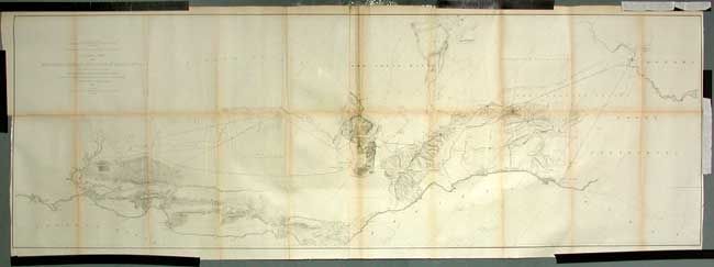
Subject: California

Period: 1853 (dated)

Publication: U.S. Pacific Railroad Surveys

Color: Black & White

Size:
73 x 24.4 inches
185.4 x 62 cm
Download High Resolution Image
(or just click on image to launch the Zoom viewer)

During the 1850s, the U.S. government sponsored an extensive series of expeditions designed to gather information on the vast new territories that had been acquired in western North America. The discovery of gold in California further stimulated westward traffic and heightened the need for a faster and more convenient way to bring the far-flung parts of the country together. In 1853 Congress commissioned the Army's Topographic Bureau to conduct a series of surveys to find a suitable route for a transcontinental railroad. There were six major expeditions; five of them covered the area between the Great Plains and west coast, and the sixth explored the coastal states of California and Oregon. All of these expeditions were accompanied by naturalists and artists to document the landscape, flora and fauna along the route. The reports, maps and lithographs were published in the 13 volume report "Explorations and Surveys to ascertain the most practicable and economical route for a Railroad from the Mississippi river to the Pacific Ocean."

Wheat calls this a "large and fascinating map that reports on the early railroad surveying in California." The map covers the region from Bodega Bay in the north to below San Diego. The Practicable Route is shown from Ft. Yuma, Arizona to San Francisco and Martinez just across the bay from Benica. Two parties explored these routes, one led by Lieut. R.S. Williamson and another by Lieut. J.G. Parke. With several parallel routes suggested in most areas, the parties commonly explored the route through the Los Angeles and San Bernardino area. Good topographical detail along routes. Some areas noted as not having been "explored instrumentally" while the "size and position are not accurately known" for Tulare Lake. Locates many towns and missions. Fine, early map from the 1855 octavo edition of the Pacific Railroad Reports.

References: Wheat (TMW) #876.

Condition: B

Issued folding, now archivally backed with tissue. Toned along some folds, otherwise a very nice example.

Estimate: $200 - $300

Sold for: $150

Closed on 3/3/2004

Archived