Catalog Archive
Auction 106, Lot 173

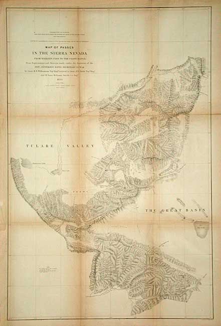
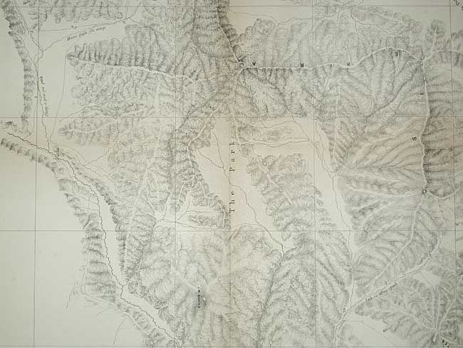
"Map of the Passes in the Sierra Nevada from Walker's Pass to the Coast Range…", Williamson, R. S. (Lt.)

Subject: California

Period: 1853 (dated)

Publication: U.S. Pacific Railroad Surveys

Color: Black & White

Size:
20.3 x 30.8 inches
51.6 x 78.2 cm
Download High Resolution Image
(or just click on image to launch the Zoom viewer)

During the 1850s, the U.S. government sponsored an extensive series of expeditions designed to gather information on the vast new territories that had been acquired in western North America. The discovery of gold in California further stimulated westward traffic and heightened the need for a faster and more convenient way to bring the far-flung parts of the country together. In 1853 Congress commissioned the Army's Topographic Bureau to conduct a series of surveys to find a suitable route for a transcontinental railroad. There were six major expeditions; five of them covered the area between the Great Plains and west coast, and the sixth explored the coastal states of California and Oregon. All of these expeditions were accompanied by naturalists and artists to document the landscape, flora and fauna along the route. The reports, maps and lithographs were published in the 13 volume report "Explorations and Surveys to ascertain the most practicable and economical route for a Railroad from the Mississippi river to the Pacific Ocean."

Very detailed map of the region centered on Tejon Pass, including the Tulare Valley, and Kern and Buenavista lakes. Locates Walker's Pass, Hum-pah-map Pass, Tah-ee-chay-pay Pass, Tejon Pass, Arroyo de las Uvas, Arroyo de San Arminio, and Fremont's route through the region in 1844. Shows a wagon road through Tejon Pass. A new pass leading to Los Angeles is also identified. Topography denoted through finely engraved hachure.

References: Wheat (TMW) #878.

Condition: B

Issued folding now tissue backed. Toned along folds.

Estimate: $80 - $100

Sold for: $60

Closed on 3/3/2004

Archived