Catalog Archive
Auction 106, Lot 171

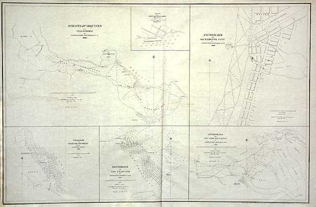
"Straits of Carquines and Vallejo Bay [on sheet with] Anchorage off Sacramento City [and] Vallejo and Mare Island Strait [and] Anchorage off San Francisco [and] Anchorage off New York of the Pacific", Ringgold, Cadwalader

Subject: California

Period: 1850 (dated)

Publication: A Series of charts, with sailing directions…

Color: Black & White

Size:
30 x 19.5 inches
76.2 x 49.5 cm
Download High Resolution Image
(or just click on image to launch the Zoom viewer)

Six lithographed maps of the principal San Francisco Bay and Sacramento River harbors are on this large sheet. The maps show unnamed streets, buoys, rocks, soundings, etc. A scarce chart from this important work on waters of California. Ringgold arrived with lieutenant Charles Wilkes on the first U.S. exploring expedition in the Pacific in 1841. He commanded the U.S.S. Porpoise and led a survey party mapping the Sacramento River as far as Colusa, and also parts of San Francisco Bay. He directed another expedition in 1849. Both of these surveys helped open up the river delta and upstream communities to increase trade with the San Francisco Bay area.

References:

Condition: B

Clean and crisp impression. Backed with archival tissue repairing a 6" binding tear. Margin extended at binding side.

Estimate: $275 - $350

Sold for: $200

Closed on 3/3/2004

Archived