Catalog Archive
Auction 106, Lot 169

"Plan du Port de St. Diego en Californie… [on sheet with] Plan du Port et du Department de St. Blas…", La Perouse, Comte Jean F. Galoup, de
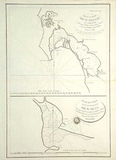
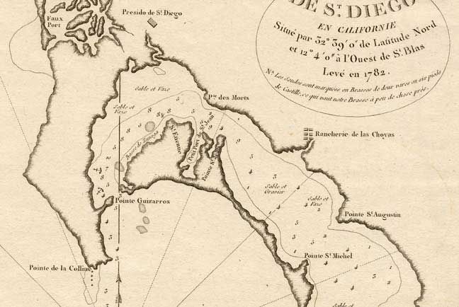
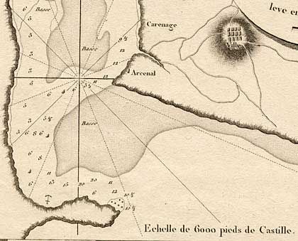
Subject: California

Period: 1797 (published)

Publication: Voyages...Autour de Monde

Color: Black & White

Size:
13 x 19 inches
33 x 48.3 cm
Download High Resolution Image
(or just click on image to launch the Zoom viewer)

One of the earliest maps of San Diego Bay, this is all the more interesting because La Perouse never actually visited San Diego. La Perouse explored from the coasts along the Gulf of Alaska and northwestern North America, through parts of Asia and Oceania. He was meticulous in sending copies of his extensive logs, maps and surveying information via other ships as well as overland. The last time the expedition was seen was in the spring of 1788 in Botany Bay, Australia. The expedition was never heard from again. The plan of St. Blas, a beautiful coral archipelago in Panama, is in the lower half of the sheet.

References: Phillips (A) 688-16

Condition: A

Dark impression on thick hand laid paper.

Estimate: $500 - $600

Sold for: $300

Closed on 3/3/2004

Archived