Catalog Archive
Auction 106, Lot 156

"Map Illustrating the System of Parcs, the Domestic Relations of the Great Plains, the North American Andes, and the Pacific Maratime Front", Gilpin, William

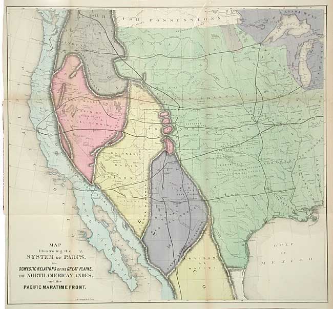
Subject: United States - Western

Period: 1873 (published)

Publication: Mission of the North American People

Color: Hand Color

Size:
22.7 x 21.2 inches
57.7 x 53.8 cm
Download High Resolution Image
(or just click on image to launch the Zoom viewer)

A fascinating and colorful map of the western United States. William Gilpin was a key figure in westward expansion and strident supporter of the transcontinental railway (which he envisioned eventually connecting with a worldwide railroad network on the 40th parallel). He believed that North America was at the height of a progression of empires, and that each movement westward carried the empire to increased greatness. Gilpin saw the Pacific Railroad as the means by which to fulfill the "untransacted destiny" of the America people. Gilpin invoked the German geographer Alexander von Humboldt's notion of the "isothermal zodiac" as further support for his vision of the American future. The map is divided into regions with a system of Parcs following the Continental Divide and the railroads cutting bold lines across the map. Also includes details of the Indian Reservations and forts, and nice detail in Texas.

References:

Condition: A

Folding as issued. Couple of tiny fold intersection splits with archival tape repairs.

Estimate: $300 - $350

Sold for: $275

Closed on 3/3/2004

Archived