Catalog Archive
Auction 106, Lot 155

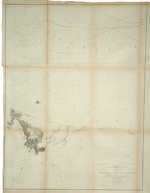
"Map No. 3 From the Santa Fe Crossing to the Coo-Che-To-Pa Pass…", Gunnison, John William [Capt.]

Subject: United States - Western

Period: 1855 (dated)

Publication: U.S. Pacific Railroad Surveys

Color: Black & White

Size:
23.7 x 31.5 inches
60.2 x 80 cm
Download High Resolution Image
(or just click on image to launch the Zoom viewer)

During the 1850s, the U.S. government sponsored an extensive series of expeditions designed to gather information on the vast new territories that had been acquired in western North America. The discovery of gold in California further stimulated westward traffic and heightened the need for a faster and more convenient way to bring the far-flung parts of the country together. In 1853 Congress commissioned the Army's Topographic Bureau to conduct a series of surveys to find a suitable route for a transcontinental railroad. There were six major expeditions; five of them covered the area between the Great Plains and west coast, and the sixth explored the coastal states of California and Oregon. All of these expeditions were accompanied by naturalists and artists to document the landscape, flora and fauna along the route. The reports, maps and lithographs were published in the 13 volume report "Explorations and Surveys to ascertain the most practicable and economical route for a Railroad from the Mississippi river to the Pacific Ocean."

The third map in this series shows the proposed routes across parts of New Mexico and today's Colorado. Details along the route surveyed include watershed and topographical via fine hachure. Locates North, Middle and South Parks, Cheyenne Pass, Saint Vrain's Fort, Pikes Peak and more.

References: Wheat (TMW) #845.

Condition: B

Some foxing and a couple of tiny holes at fold lines inside map. Backed with tissue.

Estimate: $140 - $160

Sold for: $190

Closed on 3/3/2004

Archived