Catalog Archive
Auction 106, Lot 144

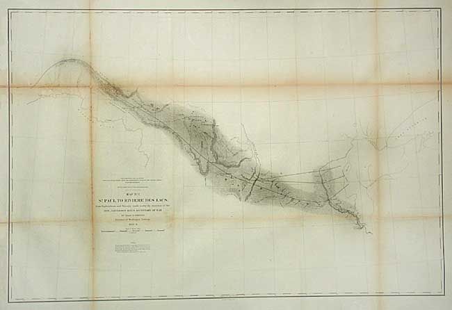
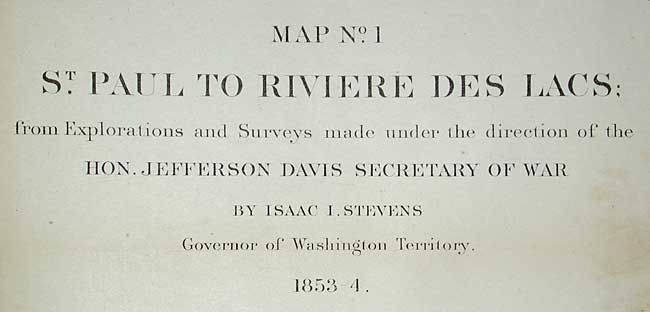
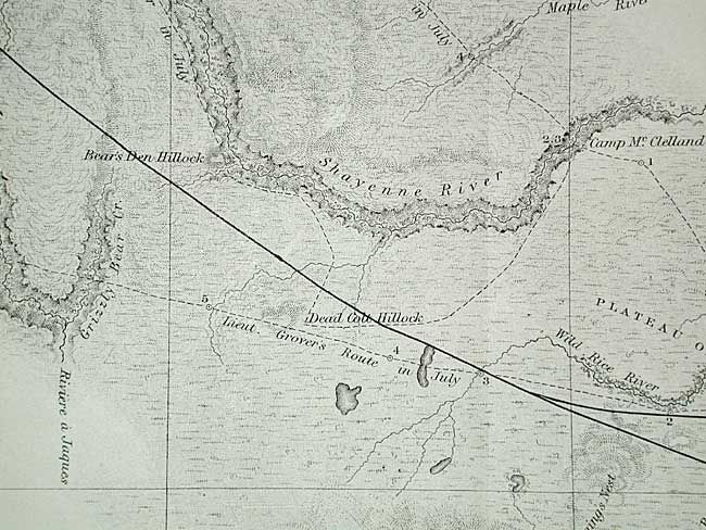
"Map No. 1 St. Paul to Riviere des Lacs…", Stevens, Isaac Ingalls

Subject: United States - Central

Period: 1853-4 (dated)

Publication: U.S. Pacific Railroad Surveys

Color: Black & White

Size:
36.7 x 24.5 inches
93.2 x 62.2 cm
Download High Resolution Image
(or just click on image to launch the Zoom viewer)

During the 1850s, the U.S. government sponsored an extensive series of expeditions designed to gather information on the vast new territories that had been acquired in western North America. The discovery of gold in California further stimulated westward traffic and heightened the need for a faster and more convenient way to bring the far-flung parts of the country together. In 1853 Congress commissioned the Army's Topographic Bureau to conduct a series of surveys to find a suitable route for a transcontinental railroad. There were six major expeditions; five of them covered the area between the Great Plains and west coast, and the sixth explored the coastal states of California and Oregon. All of these expeditions were accompanied by naturalists and artists to document the landscape, flora and fauna along the route. The reports, maps and lithographs were published in the 13 volume report "Explorations and Surveys to ascertain the most practicable and economical route for a Railroad from the Mississippi river to the Pacific Ocean."

This map details Stevens' survey efforts between St. Paul and Fort Snelling along the Plateau of the Missouri to a spot north of Union on the Yellowstone River. Excellent detail along the route. Locates Forts Snelling, Ripley, Union, Clark, and Berthold.

References: Wheat (TMW) #862.

Condition: C

Issued folding, now tissue backed to close two fold splits. Toned along folds, heavier at left portion with small areas of loss along one fold, else very good.

Estimate: $120 - $140

Sold for: $75

Closed on 3/3/2004

Archived