Catalog Archive
Auction 104, Lot 611

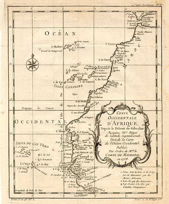
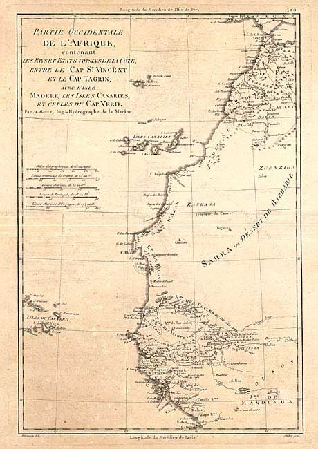
"[Lot of 2] Coste Occidentale d' Afrique… [together with] Partie Occidentale de l'Afrique contenant…", Various

Subject: Western Africa

Period: 1745-74 (circa)

Publication:

Color: Black & White

Size:
See Description
Download High Resolution Image
(or just click on image to launch the Zoom viewer)

Nice pair of 18th century French maps covering the western coast of Africa with the Canary and Cape Verde Islands. 1 - Coste Occidentale d' Afrique, Depuis le Détroit de Gibraltar Jusquáu XIe Dégré de Latitude Septentrionale b J.N. Bellin, circa 1745 (7.9 x7.9"). It is decorated with a title cartouche and compass rose with detail confined to the coastlines. 2 - Partie Occidentale de l' Afrique contenant...la Côte entre Le Cap St. Vincent et le Cap Tagrin; avec l' Isle Madere, les Isles Canaries, et celles du Cap Verde, by R. Bonne, circa 1774 ( 9.2 x 13.5"). This map has considerably more detail in Morocco and Senegal.

References:

Condition: B

Minor uneven toning and damp stains.

Estimate: $100 - $150

Unsold

Closed on 9/10/2003

Archived