Catalog Archive
Auction 104, Lot 480
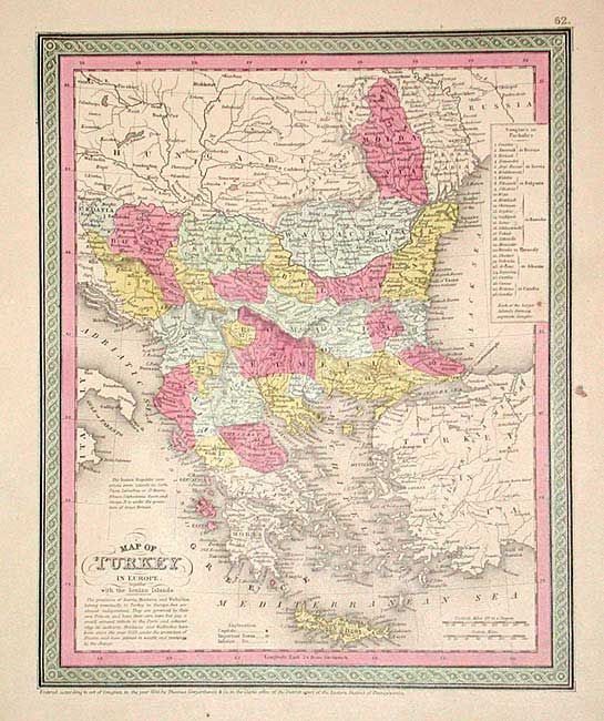
"Map of Turkey in Europe together with the Ionian Islands", Thomas, Cowperthwait & Co.
Subject: Balkans
Period: 1853 (published)
Publication: Mitchell's New Universal Atlas
Color: Hand Color
Size:
9.6 x 11.8 inches
24.4 x 30 cm
Download High Resolution Image
(or just click on image to launch the Zoom viewer)
(or just click on image to launch the Zoom viewer)