Catalog Archive
Auction 104, Lot 254

"New Map of the State of Texas Compiled from J. de Cordova's large Map", Colton, Joseph Hutchins
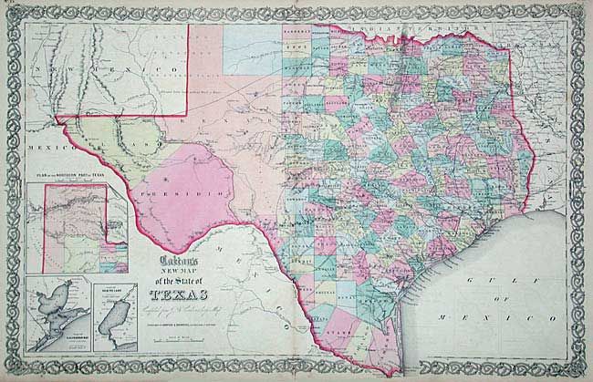
Subject: Texas

Period: 1856 (dated)

Publication:

Color: Hand Color

Size:
26 x 16.7 inches
66 x 42.4 cm
Download High Resolution Image
(or just click on image to launch the Zoom viewer)

This double-page map shows extensive detail throughout the settled part of the state. The western third is comprised of the large unsettled areas of Presidio, El Paso, Bexar and the Staked Plain. Locates railroads, forts, post offices, roads, springs, and topographical detail. Three insets: Plan of the Northern Part of Texas, Plan of Galveston Bay from the U.S. Coast Survey, and Plan of Sabine Lake. Decorative borders. Published by Johnson and Browning, circa 1860.

References:

Condition: B

Slight offsetting, else very good. Tiny split at fold repaired with archival tape.

Estimate: $350 - $450

Sold for: $425

Closed on 9/10/2003

Archived