Catalog Archive
Auction 104, Lot 238

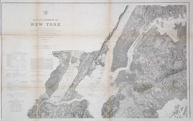
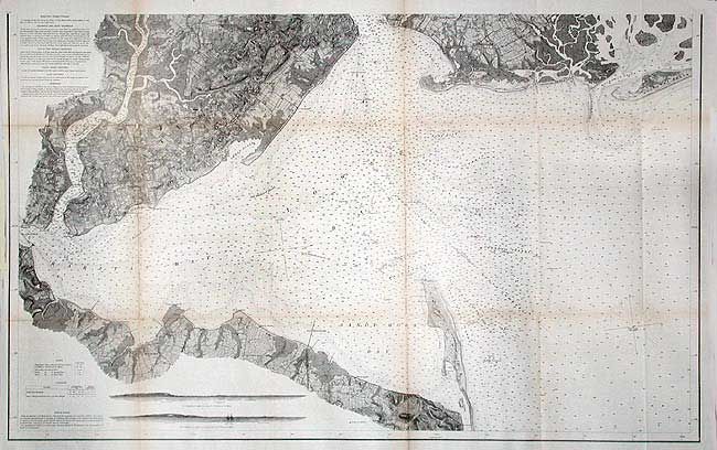
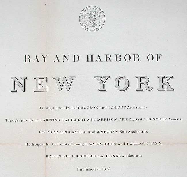
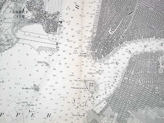
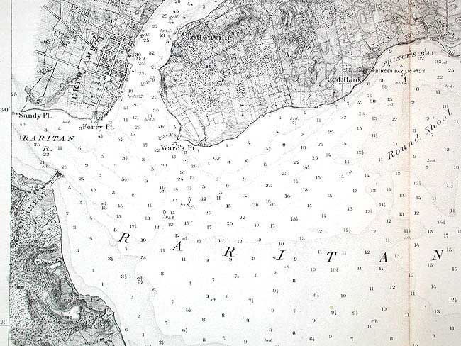
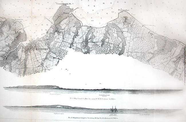
"[Lot of 2 Maps] Bay and Harbor of New York", U.S. Coast Survey

Subject: New York

Period: 1874 (dated)

Publication:

Color: Black & White

Size:
40 x 24.5 inches
101.6 x 62.2 cm
Download High Resolution Image
(or just click on image to launch the Zoom viewer)

Two matching charts meant to be joined. Covers the waterways from upper Manhattan south to Raritan Bay and Sandy Hook. Extremely well detailed throughout the coastal and interior area, including street level and even individual buildings. Stanten Island is fully developed. Insets at bottom show two offshore views of the Highland Lights, the light ship and Sandy Hook Light from different bearings. The pair will be 40" x 48" when joined.

References:

Condition: B

Both backed with archival tissue Toned along folds with a few old repairs at fold intersections.

Estimate: $200 - $250

Sold for: $350

Closed on 9/10/2003

Archived