Catalog Archive
Auction 104, Lot 213

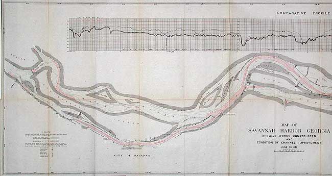
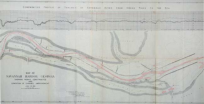
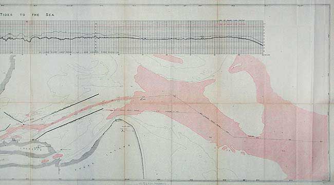
"Map of Savannah Harbor Georgia Showing Works Constructed and Condition of Channel Improvement June 30, 1896", U.S. Army

Subject: Georgia

Period: 1896 (dated)

Publication: Capt. O.M. Carter's Report

Color: Hand Color

Size:
85 x 18.5 inches
215.9 x 47 cm
Download High Resolution Image
(or just click on image to launch the Zoom viewer)

Exceptionally detailed plan delineates 28 miles of the river with a full-length profile above. Extends from Argyle Island to the sea. Filled with islands, notations, channel buoys, etc. Locates Forts Pulanski and Oglethrope, the Cockspur, Red and Tybee lighthouses, the City of Savannah, and much more.

References:

Condition: B

Remarkable condition for a map of this size. Toned along some folds and two short splits at fold intersections.

Estimate: $150 - $200

Unsold

Closed on 9/10/2003

Archived