Catalog Archive
Auction 104, Lot 175

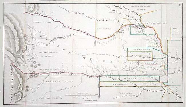
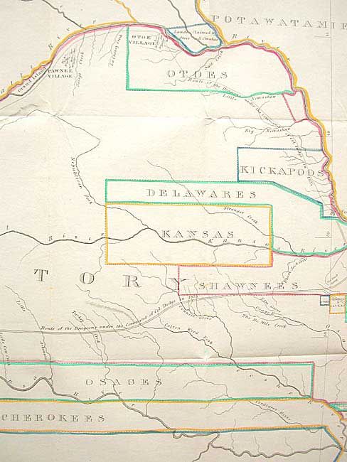
"[Route of Col. Dodge's Expedition from Fort Leavenworth to the Rocky Mountains]", U.S. Government

Subject: United States - Midwest

Period: 1836 (published)

Publication: Journal of the Expedition…under the Command of Colonel Henry P. Dodge…

Color: Hand Color

Size:
34.5 x 19.5 inches
87.6 x 49.5 cm
Download High Resolution Image
(or just click on image to launch the Zoom viewer)

A superb lithographed map covering the region of present day Kansas, Nebraska, and Colorado. The various Indian Districts are delineated and colored in outline with the notation Lands Ceded by Sioux, Sacs, Foxes, Otoes, Ioways, &c. in 1825. The route of the Dragoons is shown starting at Ft. Levenworth and following the Santa Fe Road and then the Arkansas River (also marked as the United States Boundary) to just before Pike's Peak, then moving north through the Snake & Crow's War Ground to the return trip along the Platte River.

References: Claussen & Friis #128; Wagner-Camp #63; Wheat [TMW] #411.

Condition: A+

A very fine example with bright original color. Folding as issued with good margins all around. Toned at paper edge.

Estimate: $450 - $550

Sold for: $475

Closed on 9/10/2003

Archived