Catalog Archive
Auction 104, Lot 126

"Canada Louisiane et Terres Angloises", D'Anville/Santini

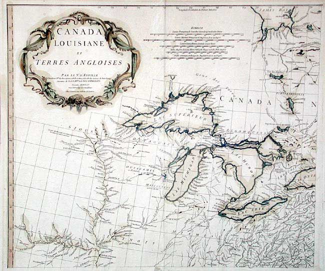
Subject: Colonial Great Lakes

Period: 1755 (dated)

Publication:

Color: Hand Color

Size:
21.8 x 18.7 inches
55.4 x 47.5 cm
Download High Resolution Image
(or just click on image to launch the Zoom viewer)

The northwest sheet of a four-sheet map featuring the Great Lakes and upper Mississippi River. Large, decorative cartouche designed by Gravelot. The map was based in part on Mitchell's famous map of the United States. D'Anville's usual, superb cartographic detail throughout.

References: Cumming (SE) #296;Tooley (Amer) p.316.

Condition: B

Faded color with faint mat burn in margins. Several tissue repairs in lower margin, a couple repairing short tears just entering map.

Estimate: $450 - $500

Sold for: $425

Closed on 9/10/2003

Archived