Catalog Archive
Auction 103, Lot 363

"Carte du Diocese de Narbonne", Delisle/Covens & Mortier
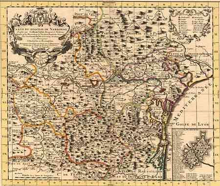
Subject: France

Period: 1739 (dated)

Publication:

Color: Hand Color

Size:
23 x 17.7 inches
58.4 x 45 cm
Download High Resolution Image
(or just click on image to launch the Zoom viewer)

Beautifully engraved map of the Narbonne region. The map details the churches, parishes, abbeys, roads and villages with appropriate highlighting for those of importance. Includes the walled cities of Beziers, Bourg, Villebasse, Alet and more. Inset plan of the fortified city of Narbonne. Map is set within a descriptive index table. Map inside text measures 18.5 x15.6".

References:

Condition: A

Dark impression and fine original color. Hint of toning along fold, still very good to fine.

Estimate: $180 - $220

Sold for: $130

Closed on 6/11/2003

Archived