Catalog Archive
Auction 103, Lot 147

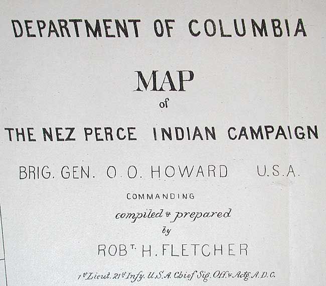
"Department of Columbia Map of the Nez Perce Indian Campaign Brig. Gen. O O Howard", U.S. Government

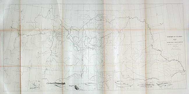
Subject: Northwestern United States

Period: 1877 (published)

Publication: HR ex Doc.1, 45th Cong., 2nd Session

Color: Black & White

Size:
45.8 x 21.5 inches
116.3 x 54.6 cm
Download High Resolution Image
(or just click on image to launch the Zoom viewer)

A detailed map of the historic and skillful retreat of the Nez Perce Indians in the winter of 1877. The map identifies forts, battle sites, trails, direction of troop movements, etc. In the face of relentless pursuit by the troops under Gen. Howard, Chief Joseph and his small band (less than 500 people including women and children) fought one of the most extraordinary Indian Wars in American history. The map, which includes many notes and vignette views, records their retreat through the Bitterroot Mts., twice across the Rocky Mountains, through Yellowstone National Park, across the Missouri River to the Bear Paw Mountains. They surrendered on Eagle Creek, only 30 miles from their destination. An extraordinary map that covers Washington, Oregon, Idaho, Montana, Wyoming, Dakota, and Nebraska. Seven vignettes along the bottom show various fights and battles plus an inset map titled "Scene of the Outbreak." A large and historical map of one of the most tragic Indian campaigns.

References:

Condition: B

Issued folding, now backed with archival tissue. Toned along folds with some minor separations.

Estimate: $200 - $250

Sold for: $110

Closed on 6/11/2003

Archived