Catalog Archive
Auction 103, Lot 142

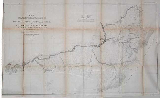
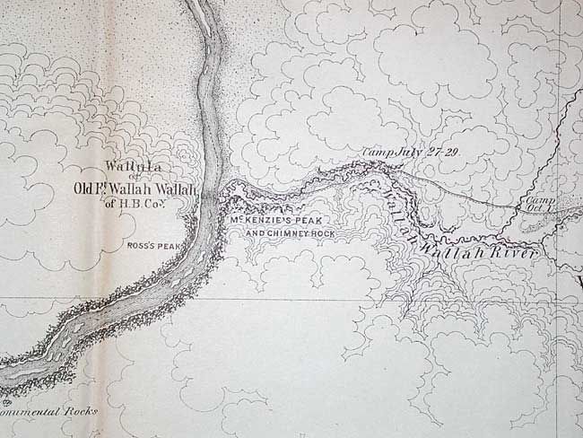
"Map of Military Reconnaissance from Fort Dalles, Oregon, via Fort Wallah- Wallah, to Fort Taylor, Washington Territory…", U.S. War Department

Subject: Western United States

Period: 1863 (dated)

Publication: Sen. Doc #43, 37th Cong 3rd Sess.

Color: Black & White

Size:
35.5 x 21.3 inches
90.2 x 54.1 cm
Download High Resolution Image
(or just click on image to launch the Zoom viewer)

One of the Mullan Trail maps. Wheat states "The Mullan Trail was unquestionably the most famous road ever constructed in the high Northwest." Highly detailed map with contour lines at 100 ft. intervals. Locates the Emigrant Road to the States (Oregon Trail), Whitman's old Mission, the forts Taylor, old and new Wallah Wallah, and Dalles. Excellent detail along the Columbia River.

References: Wheat (TMW) #1077.

Condition: B

Toned along a fold with some splitting with no loss, else very good.

Estimate: $80 - $100

Sold for: $60

Closed on 6/11/2003

Archived