Catalog Archive
Auction 103, Lot 104
"Partie de l'Amerique Septentrionale qui comprend le Canada, la Louisiane, le Labrador, le Groenland, la Nouvelle Angleterre, la Floride &c.", Bonne, Rigobert
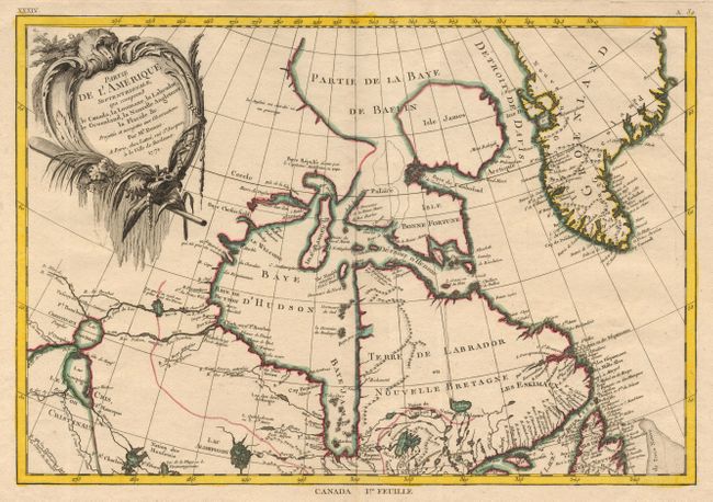
Subject: Canada
Period: 1771 (dated)
Publication: Atlas Moderne ou collection de Cartes sur toutes les Parties du Globe Terrestre
Color: Hand Color
Size:
17 x 11.75 inches
43.2 x 29.8 cm
Download High Resolution Image
(or just click on image to launch the Zoom viewer)
(or just click on image to launch the Zoom viewer)