Catalog Archive
Auction 102, Lot 81

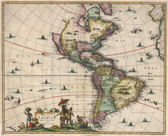
"Novissima et Accuratissima Totius Americae Descriptio", Schagen, Gerrit Lucaszoon van

Subject: Western Hemisphere

Period: 1671 (circa)

Publication:

Color: Hand Color

Size:
21.4 x 17.2 inches
54.4 x 43.7 cm
Download High Resolution Image
(or just click on image to launch the Zoom viewer)

Uncommon decorative map of the Americas based largely on Visscher's map of 1658. California is shown as a large island with a flat northern coastline. The mainland coastline continues northeast toward the Straet Anian, which separates it from Anian. In the Southwest, the Rio del Norto flows from a large interior lake, and empties into to the sea between the mainland and California. One of its most recognizable features is the huge open-ended lake in the vicinity of the Great Lakes. In South America, Parime Lacus is prominent. The most outstanding features of the map are the beautifully engraved decorative details that include numerous vignettes of wildlife and sailing ships. At bottom, Native Americans trading with Europeans surround the title.

References: McLaughlin #52; Tooley (Amer) p. 121, #34.

Condition: A

Folds as issued with expert and invisible repairs at a couple of intersections.

Estimate: $2,000 - $2,500

Sold for: $1,500

Closed on 3/5/2003

Archived