Catalog Archive
Auction 102, Lot 341

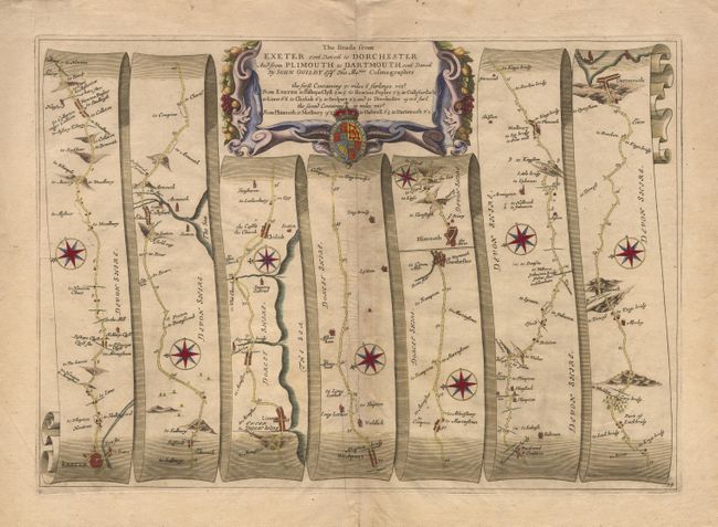
"The Roads from Exeter com Devon to Dorchester and from Plimouth to Dartmouth com Devon", Ogilby, John

Subject: England

Period: 1675 (circa)

Publication: Britannia

Color: Hand Color

Size:
18 x 12.8 inches
45.7 x 32.5 cm
Download High Resolution Image
(or just click on image to launch the Zoom viewer)

John Ogilby's 'Britannia' was published between 1675 and 1698. It is a landmark in the mapping of England and Wales. Its unique format constituted the first national road-atlas of any country in Western Europe. It was composed of maps of seventy-three major roads and cross-roads, presented in a continuous strip-form, on a uniform scale of one inch to a mile. Each beautiful map includes wonderful detail of the countryside with each strip containing a large compass rose to indicate changes in direction.

Charming map showing the roads from Exeter to the sea at Dorchester, and from Plymouth to Dartmouth, passing all manner of small towns and churches along the way. This map is decorated with eight compass roses, as well as a garland cartouche anchored with a coat-of-arms.

References:

Condition: B

Light printer's crease and slight toning along fold.

Estimate: $300 - $350

Sold for: $220

Closed on 3/5/2003

Archived