Catalog Archive
Auction 102, Lot 266
"An Accurate Map of the Island of Barbadoes Drawn from an Actual Survey containing all the Towns Churches Fortifications Roads Paths Plantatinos &c.", Bowen, Emanuel
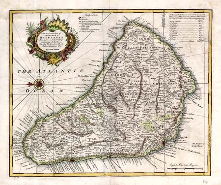
Subject: Barbados
Period: 1747 (circa)
Publication:
Color: Hand Color
Size:
16.8 x 13.8 inches
42.7 x 35.1 cm
Download High Resolution Image
(or just click on image to launch the Zoom viewer)
(or just click on image to launch the Zoom viewer)